

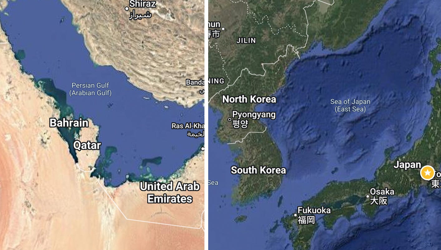
𝗪𝗵𝘆 𝗴𝗹𝗼𝗯𝗮𝗹 𝗺𝗮𝗽 𝗰𝗿𝗲𝗮𝘁𝗼𝗿𝘀 𝘀𝗵𝗼𝘂𝗹𝗱 𝗻𝗼𝘁 𝗽𝗼𝗹𝗶𝘁𝗶𝗰𝗶𝘇𝗲 𝘁𝗵𝗲𝗶𝗿 𝘄𝗼𝗿𝗸. The clamoring about how place names are shown on maps (e.g. Lake Ontario/Lake America) is understandably emotional. It is also unfortunate. Bear with me. Yes, I worked for Google. My deep exposure to the intricacies of such questions left me with a bias towards an apolitical global approach.
Place names around the world are often controversial, many times arbitrary, and sometimes capricious. Look around and you will find examples, from geographic features to schools, bridges, military bases. Globally, there are many conflicts between countries that share frontage to a body of water or have disputed boundaries. There is nothing new here. It has happened thousands of times.
Google, and most major map companies, follow a common practice: they reflect what what has been placed in a country's official names database. In the US, name changes become official only when added to the US Geological Survey's Geographic Names Information System. It and its precursors have been in place since 1890. Most countries do the same. When names conflict, Google, and other map providers, will show residents of a country the name their country designates. From Shanghai, the Sea of Japan is the East Sea. From France, the English Channel is La Manche. If you look at a map from Canada right now, you will see Lake Ontario, while in the US it is Lake America. From outside the conflicted countries, often both names are shown.
It is important we have neutral geographic naming structures that follow a standard process. Yet, some demand map companies take a side: to be an advocate, to politicize, even though various international governance organizations, from standards bodies to the UN, wisely avoid such matters.
In the US, the executive branch has the power to make such changes. No legislative or judicial review is required. Some might want to challenge that but it is how place naming has been managed. It is often political. They swing with the politics of those in office. The historical indigenous name of Mt Denali has now swung back and forth to McKinley, then Denali, then McKinley again.
Many seem to suggest a mapping service should have a political arm to weigh in on such matters in opposition to whatever governmental structures are in place. Where does that end, or begin? Do we want left wing maps and right wing maps? Does that make sense in a world inclined to politicize everything into blue vs red, left vs right, my team versus yours? The long-held principles of behavior followed by map organizations can and should be upheld. The principles are sound. Irrespective of my own view about any specific name, I will stand by that principle.
Sound advice. I wrote this piece on why and when places change names (spoiler alert: It happens more often than you might think.) https://bbc.com/travel/article/20231120-why-do-countries-change-name